NOAA Weather Radio All Hazards (NWR) is a nationwide netword of radio stations broadcasting continuous weather information directly from a nearby National Weather Service Office. NWS broadcasts National Weather Service warnings, watches, forecasts and other hazard information 24 hours a day.
Working with the Federal Communication Commission's (FCC) Emergency Alert System, NWR is an "All Hazards" radio network, making it your single source for comprehensive weather and emergency information. In conjunction with Federal, State, and Local Emergency Managers and other public officials, NWR also broadcasts warning and post-event information for all types of hazards – including natural (such as earthquakes or avalanches), environmental (such as chemical releases or oil spills), and public safety (such as AMBER alerts or 911 Telephone outages).
Known as the "Voice of NOAA's National Weather Service," NWR is provided as a public service by the National Oceanic and Atmospheric Administration (NOAA), part of the Department of Commerce. NWR includes more than 1000 transmitters, covering all 50 states, adjacent coastal waters, Puerto Rico, the U.S. Virgin Islands, and the U.S. Pacific Territories. NWR requires a special radio receiver or scanner capable of picking up the signal. Broadcasts are found in the VHF public service band at these seven frequencies (MHz):
|
|
|
|
|
|
|
Texas NOAA Radio Forecasts/Conditions | ||||
|  |
|||
|
Virginia Weather Radio Frequencies |
|||||
Site Name |
Transmitter Name |
Call Sign |
Frequency |
Power |
County |
|
|
|||||
|
|
|||||
|
|
|||||
|
|
|||||
|
|
|||||
|
|
|||||
|
|
|||||
|
|
|||||
|
|
|||||
|
|
|||||
|
|
|||||
Local Dallas/Ft Worth HAM Radio Freqs |
||
County |
FREQUENCY |
|
Blackmore WX METAR |
) |
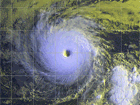
Local RADAR Loop |
) |
Southern Plains Loop |
) |
Gulf Coast Loop |
) |
National RADAR Loop |
) |
Jet Stream Loop |
) |
GOES-East SAT |
) |
Weather Alerts |
Click Here to subscribe to Blackmore Weather Station Local Weather Alerts |
Lightning Alerts |
Click Here to subscribe to Blackmore Weather Staiton Thunderstorm Warnings and receive local thunderstorm warnings via email. |
Support Us |
Website Scanner |
|
| Scan Now Site Now! Scan will take a few mintues |
SSL Certificate |
 |